Why does the satellite image look imprecise or is not loading?
Why does the satellite image look imprecise or is not loading?
The reason for this is usually one of the following:
There is no high-resolution satellite image available from the location and time you selected.
Atmospheric phenomena interfere with observations.
There are delays in processing of satellite observations.
These are described in more detail below.
Spatial resolution
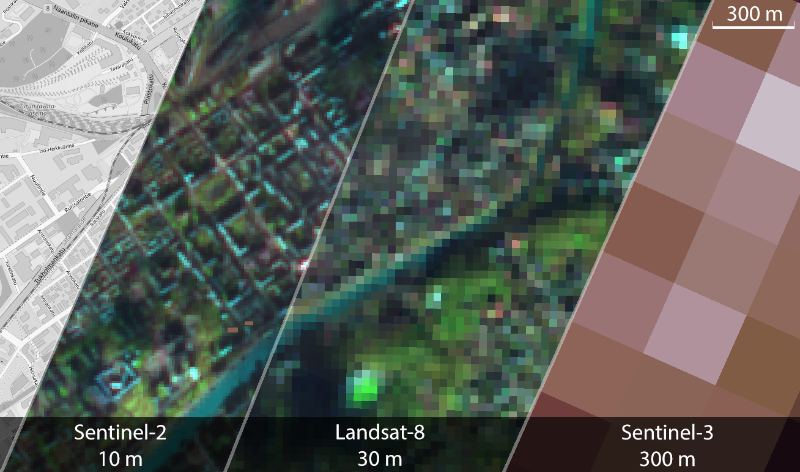
Depending on the satellite, the spatial resolution of the Tarkka images ranges from 10 m to 300 m. This means that at the most accurate magnification levels of Tarkka, the pixels nominal resolution range from 10 m to 300 m, depending on the satellite:
The resolution of the Sentinel-2 is 10 meters
The resolution of the Landsat-8/9 OLI is 30 meters
The resolution of the Sentinel-3 is 300 meters
The resolution of the Landsat-4/5 TM is 30 meters
Of these, Sentinel-2 MSI and Landsat-8 OLI are referred as high resolution (HR) satellite instruments and Sentinel-3 OLCI is a medium resolution (MR) satellite instrument. The high-resolution satellites capture bands about 200 km wide every day, so they do not produce daily satellite images of the whole of Finland. Medium-resolution satellites, on the other hand, produce observations covering the whole of Finland on a daily basis, but the spatial resolution of the images produced from them is not enough to distinguish the details of the terrain. This may give the impression of an imprecise satellite image.

Atmospheric phenomenas
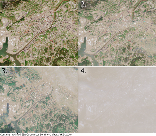
Optical instruments do not distinguish the ground through the cloud cover. In addition, cloud droplets (fog) affect image quality. Thus, if the area you select is on a cloud-covered region or fog zone, the image will appear out of focus or white throughout.
Processing delays
The lack of data due to processing delays happens occasionally. During these occasions, the satellite image does not seem to appear in the Tarkka service. Before entering the Tarkka service, satellite observations go through a long processing chain, where planned or unplanned interruptions or delays may occur. In this case, the latest satellite observations do not appear in Tarkka on a normal schedule, but with a delay of a day or two, for example.
Due to the technology behind Tarkka, the images with the highest-zooming overview level will be the first to appear in the service. Therefore, if the satellite imagery overview at coarser accuracy does not load, you can zoom in, and in most cases the images will appear. Overview levels are completed with a delay of about a day.
