How to download GeoTIFF raster from Syke’s WCS interface?
Syke’s satellite observations and raster-format GIS datasets are available as GeoTIFF raster datasets via WCS-interface. The interface can be used either with a software or by web browser. A list of Syke’s open WCS can be found from https://www.syke.fi/en/environmental-data/open-web-services. The Web map services (Syke.fi) offers multiple GIS-datasets. Earth Observation datasets can be found from EO web map services (Syke.fi).
WCS-interface instructions
Capabilities document
Before creating a WCS request it’s recommended to check which coordinate reference system the WCS is published. The satellite observation data is either in WGS84 (EPSG:4326) or in ETRSTM35-FIN (EPSG:3067) coordinate reference system. This can be checked from the Capabilities document, which you can get with the following request:
https://geoserver2.ymparisto.fi/geoserver/eo/wcs?request=GetCapabilities
Raster-format GIS data are in ETRSTM35-FIN (EPSG:3067) reference coordinate system. The WCS-interfaces can be found at https://www.syke.fi/en/environmental-data/open-web-services. The capabilities-document is submitted for singular requests instead of the whole server. Here is an example for Scalgo landcover dataset:
https://paikkatiedot.ymparisto.fi/geoserver/syke_maanpeitescalgo/wcs?request=GetCapabilities
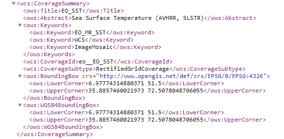
From the request you can find from the BoundingBox element which the coordinate reference system the dataset has.
Data request
For the application use of WFS and WFC services, we recommend you to adopt for your application a unique identifier, which you can get by asking from Syke’s GIS support gistuki@syke.fi. By requesting the identifier you approve that your contacts are stored in accordance with Syke’s data protection policies. Data protection notification (in Finnish). Remember to add your unique key to the end of the webrequest address …&sykeuserid=“unique key” (see the first example in the Examples-section on this page)
To the WCS request you must define:
WCS-address: https://geoserver2.ymparisto.fi/geoserver/ows
Type of service: service=WCS
Service version: version=2.0.1
Type of request: request=GetCoverage
Area
SUBSET=Lat(y1,y2)&SUBSET=Long(x1,x2), example: Lat(61.01847,61.33005)&SUBSET=Long(20.77862,21.50516)
- Lat & Lon when the dataset is in WGS84 (EPSG:4326) coordinate reference system
- Lat: Latitude coordinates, first the most Southern and second the Northern
- Long: Longitude coordinates, first the most Western and second the Eastern
- You can find these for example from Tarkka Map Viewer
SUBSET=N(y1,y2)&SUBSET=E(x1,x2), example: SUBSET=N(6704362.2,6710330.2)&SUBSET=E(496609.7,514108.3),
- N & E when the dataset is in ETRS89/TM35FIN coordinate reference system
- N is the Northern coordinate and E is the Eastern coordinate
- These coordinates can be found for example from the public maps
Layer name: coverageId, example coverageId=eo:EO_SST, where eo referes to dataset location on server and EO_SST referes to layer name
coordinate reference system (CRS): select the wanted crs, subsettingcrs, example: subsettingcrs=https://www.opengis.net/def/crs/EPSG/0/4326 if you want WGS84
Format: format=image/tiff when you need GeoTIFF
Time: SUBSET=time(), example: SUBSET=time(“2021-04-20T00:00:00Z”) when the dataset has for example daily data
sykeuserid sykeuserid=“your unique key”
Examples
Satellite observation 20th of April in 2021 of water surface temperature (EO_SST) from defined area in WGS84:
Satellite observation 26th of April in 2021 of snow cover (EO_FSC) from defined area in WGS84:
Satellite observation 16th of July in 2020 of surface algae (EO_HR_WQ_S2_ALGAE) from defined area in WGS84:
Satellite observation 1st of June in 2021 of turbidity (EO_HR_WQ_S2_TURB) from defined area in ETRS89/TM35FIN:
Some of the Tarkka’s datasets are in the Finnish Meteorological Institutes WCS. For request on these datasets:
- WCS-address: https://data.nsdc.fmi.fi/geoserver/ows
Examples:
Satellite observation 31st of August in 2019 interpreration of Normalized Difference Vegetation Index (NDVI) from defined area in WGS84:
Satellite observation 31st of August in 2019 interpreration of Normalized Difference Vegetation Index (NDVI) from defined area in ETRS89/TM35FIN:
Previous example with unique identifier:
Example of raster-format WCS request
Landcover dataset from Scalgo-service: Landcover Scalgo 2022 from vegetation height: