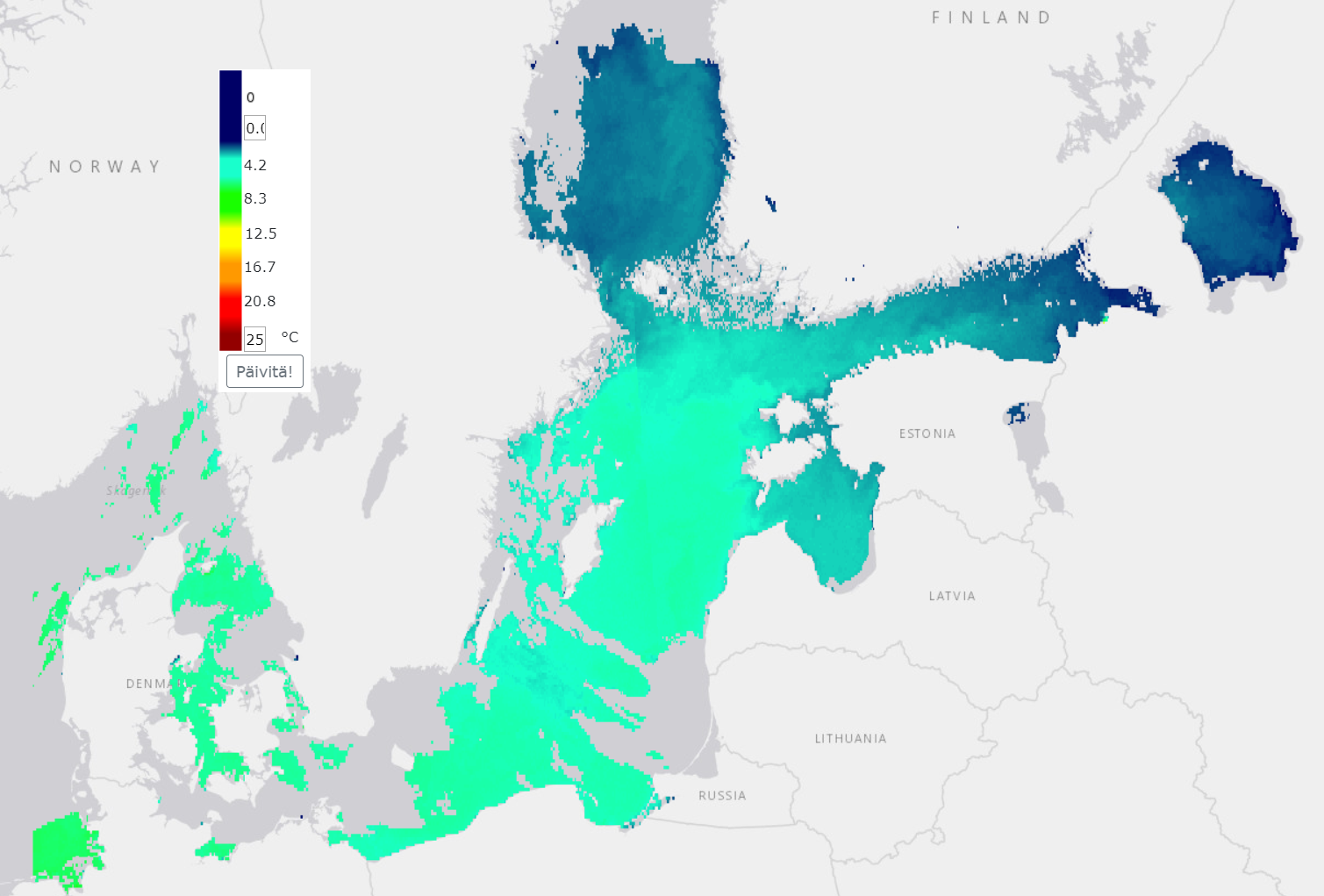
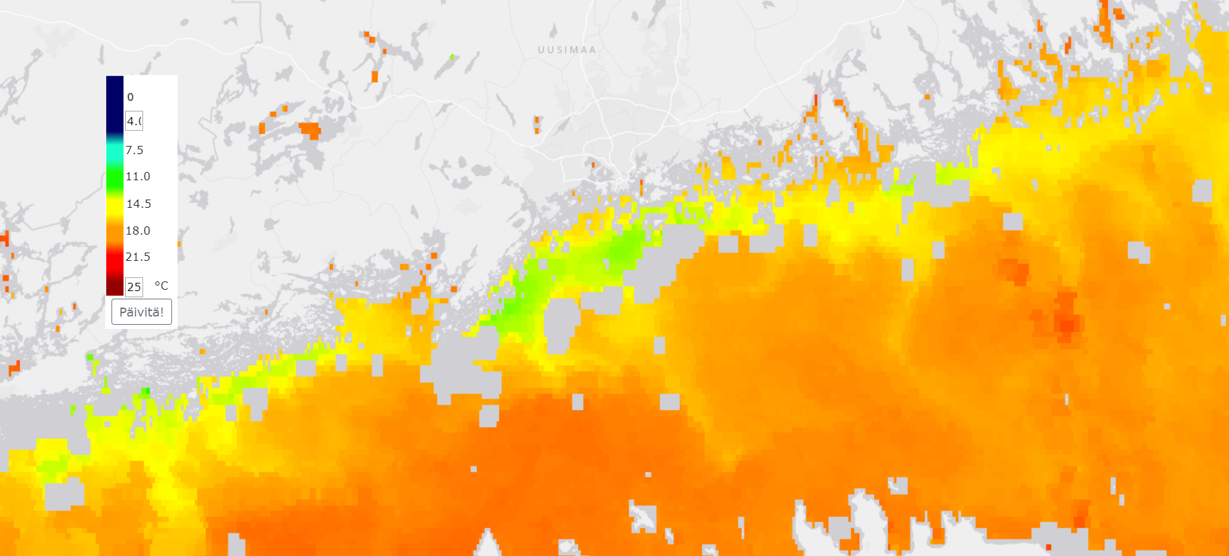
Water surface temperature (SST)
Syke produces surface temperature data for the Baltic Sea region and the largest lakes in Finland. In the data, the temperature variations of the water surface layer are described by means of a color map (legend) from blue or cold water to red or warmer areas. Full year coverage is available starting from the winter of 2020, and in previous years the data cover the period from the beginning of April to about the end of October. Today, the interpretation uses the SLSTR instruments of ESA’s Copernicus program’s Sentinel-3 satellite series, which have an observation accuracy in the terrain of about 1 km. The background reference map is visible in areas where there is land, clouds, ice, or missing observation for other reasons.
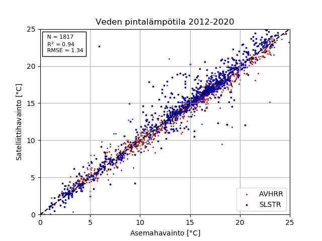
The surface temperature time series begins in 2004 and consists of observations from various satellite instruments. In 2004-2016, the data were made from the findings of the NOAA AVHRR instrument. From 2017 onwards, the current SLSTR instruments have been in use. Surface temperatures are interpreted from satellite observations using the so-called by the split window calculation method commonly used in marine areas (McClain et al. 1985, Pichel 1991, Walton et al. 1998). The data cover the entire Baltic Sea area and the terrain resolution is about 1 km. Satellite overflight routes vary on different days. In the edge areas of images, the pixel size may be larger. The surface temperature data correspond very well to the station observations measured from a depth of about one meter (r^2> 0.9, RMSE 1.7 °C, bias -0.32 °C, N = 827, years 2012-2019).
References
McClain EP, Pichel WG, Walton CC (1985). Comparative performance of AVHRR-based multichannel sea-surface temperatures, Journal of Geophysical Research, 90: (c6) 1587-1601, 1985.
Pichel WG (1991). Operational production of multichannel sea-surface temperatures from NOAA polar satellite AVHRR data, Global and Planetary Change, 90: (1-3) 173-177, 1991.
Walton CC, Pichel WG, Sapper JF, May DA (1998). The development and operational application of nonlinear algorithms for the measurement of sea surface temperatures with the NOAA polar-orbiting environmental satellites, Journal of Geophysical Research, 103: (C12) 27999-28012, 1998.