True-color images in the Map viewer
The default view of Tarkka Map viewer provides a comprehensive combination of true-color images from the most recent observation day. The images are sourced from available satellite instruments with observations on that particular day. Map layers are organized based on spatial resolution. When zooming in on the map at the finest levels, terrain features as small as approximately 10 meters can be distinguished. Images from the finest resolution instruments (Sentinel-2 MSI, Landsat-8/9 OLI) are shown by default, and Sentinel-3 OLCI imagery is also optionally available.
At the bottom level of the map layer, observations with the coarsest spatial resolution are shown: Sentinel-3 OLCI instrument observations with a spatial resolution of 300 meters. Above this, finer-resolution datasets are presented, such as Sentinel-2 MSI’s 10-meter sptial resolution observations, as well as Landsat-8/9’s 30-meter observations whenever available. Sentinel-2 MSI’s 10-meter observations are always displayed as the top layer. Additionally, previous years’ (1982-2012) images from Landsat-4/5 can be selected as well.
Not all areas are observed every day, so the spatial resolution of the true-color image varies depending on the coverage of different satellite observations on a given day.

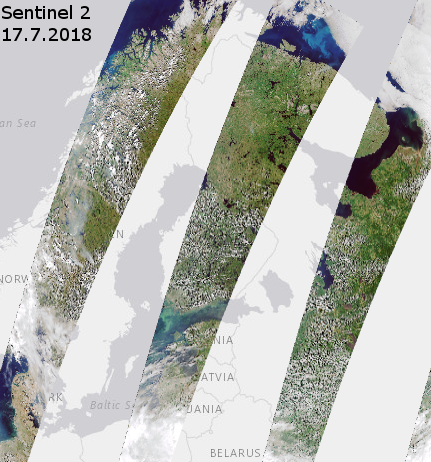
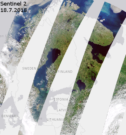
From the left-side dataset selector, you can choose to exclude observations with coarser spatial resolution and keep only Sentinel-2 series instrument observations, creating a sliced view in the map. This occurs because the satellites’ coverage areas are narrow, and they capture slightly different regions on different days. Overpasses of Sentinel-2 are illustrated in the image below. However, multiple observations accumulate over the week from the same area.