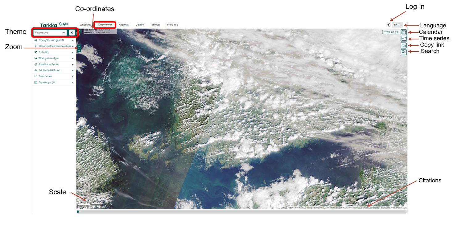
Functionalities of the Map viewer
In the Map viewer, satellite observations can be utilized as a map dataset. The default view in the Map viewer presents the latest true-color image observations from various satellite instruments. Also, users can examine observations as time series. In addition to satellite observations, it is possible to include in situ and automatic station observations in the view. Due to the abundance of data, users can choose predefined themes in the Map viewer. By selecting a theme, the view is narrowed down to the observations that fit the specific conditions of the theme. For example, two of these themes are Blue-green algae and Lake ice service. The thematic views makes it easier to use and analyze the Tarkka service for the desired theme, since supporting materials for the selected theme are visually presented as a single collection. For example, Blue-green algae theme visualizes the true-color images and algae datasets for marine areas. The default view in Map viewer is the true color satellite image from previous day. The daily satellite observations become available around 4 pm and are selectable from the calendar. The datasets are updated as they become internationally available. Other satellite datasets, such as water surface temperature and turbidity, can be selected from the left-hand dataset menu.
- Selection of observation date
- Map features
- Searching for cloudless days
- Choosing the materials to be presented
- Time series of the Regions and Stations
- Location and area search
- True color images in the Map viewer